Quick Navigation
Sarek National Park is located in northern Sweden in the province of Lapland; it is part of the Scandinavian Mountains. The park covers an area of 760 square miles (1,970 sq km) and the boundaries of the park come close to being a symmetrical circle. It’s about 31 miles (50 km) across the park.
Sweden has 13 summits that reach a height of over 6,600 feet (2,000 m) and six of these are found within the boundaries of the park. Sarektjakka, at 6,854 feet (2,089 m), has the second-highest summit in the country and the tallest within the Sarek park perimeter.
In addition to these 6 magnificent peaks, there are another 200 summits that reach heights of 5,900 feet (1,800 m). It is the most mountainous area in Sweden. Lake Rittakjaure represents the lowest elevation at 1,565 feet (477 m).
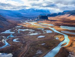
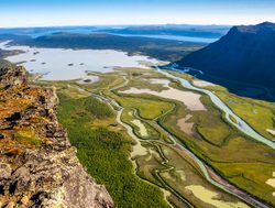
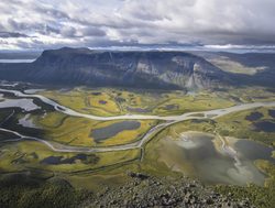
The landscapes feature significant valleys, tremendous mountains, and high plateaus. The Rapa Valley is the most popular and accounts for 15 square miles (40 sq km) of the park area. This valley delta provides visitors with one of the most impressive views of Mount Skierfe, while in return the summit looks out over the glacial trough valley.
There are numerous glaciers found within the various valleys. With over 100 glaciers it is one of the most glacier populated areas in the country. The largest glacier is Partejekna which covers an area of 4.2 square miles (11 sq km).
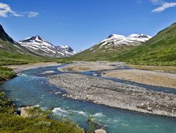
All of the valleys are bound with majestic summits standing over them. There are multiple lakes with Alkajaure being the largest and bordering Sarek and neighboring Padjelanta Park.
Because of the elevations and lack of vegetation, there are only 24 mammalian species and 2 each of reptiles and amphibians. The birds are more diverse with 142 species found within the park boundaries.
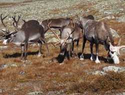
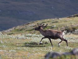
Wildlife does include moose, wolverine, brown bear, lynx, red fox, arctic fox, marten, and weasels.
Highlights
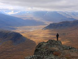
Sarek National Park is a great place to trek, hike, and engage in mountaineering. However, it is important to note that there are no marked trails; it is often helpful to engage a guide to help you explore. It is affectionately referred to as one of "Europe's last true wilderness areas."
There are limited accommodations and life is remote. Hikers are recommended to be prepared for shifting weather conditions that could lead them trapped by the weather This is the adventurer’s national park and not really for the casual hiker.
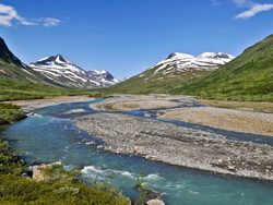 Rapa River Valley
The Rapa River Valley stretches across the park 22 miles (35 km). The valley is nestled between stunning mountains that overlook the lush green river valley. The river has a number of tributaries that help contribute to the vegetation success of the valley.
Sarektjakka
Sarektjakka is the tallest mountain in the national park with an elevation of 6,854 feet (2,089 m) and Sweden's second-highest summit. There are no road accesses to the mountain, so just reaching it often requires at least a day of backcountry trekking.
Approaching the summit from the south requires being in excellent physical condition with a steep ascent as well as trekking across glaciers. It is a wilderness adventure for the mountaineer.
Sarek National Park Trails
Sarek National Park is known for its remote wilderness. The majority of hiking is backcountry trekking and camping. Two of the recognized excursions in the park are both multi-day endeavors. Sarek is really for the backpacker who has the vision of multi-day time out in the wilderness with little to no signs of human life.
Be prepared for rainy and cold weather which can happen at any time even during the summer months of June, July, and August. Raingear is a necessity.
Sarek Highlights
- Rapa River valley
- Sarektjakka (highest peak in park)
- Glacier exploration
Park Map
Sources
- All Trails, Best Trails in Sarek National Park, https://www.alltrails.com/parks/sweden/norrbotten/sarek-national-park, retrieved June 2020.
- Backpacker, Sarek National Park, Sweden, https://www.backpacker.com/trips/sarek-national-park-sweden, retrieved August 2019.
- Britannica, Sarek National Park, https://www.britannica.com/place/Sarek-National-Park, retrieved June 2020.
- Lonely Planet, Sarek National Park, https://www.lonelyplanet.com/sweden/attractions/sarek-national-park/a/poi-sig/1062485/360777, retrieved August 2019.
- Sweden, Sarek National Park, https://www.sweden.org.za/sarek-national-park.html, retrieved August 2019.
- The Hiking Life, Sarek National Park, https://www.thehikinglife.com/2010/10/sarek-national-park-sweden-2009/, retrieved June 2020.
- UNESCO, Laponian Area, https://whc.unesco.org/en/list/774/, retrieved August 2019.
